

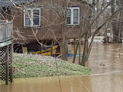
Floodplains are part of a healthy natural system, supporting biological diversity, slowing stormwater, and enhancing groundwater recharge.
How it Works
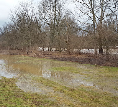
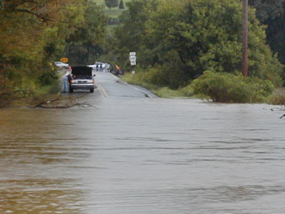
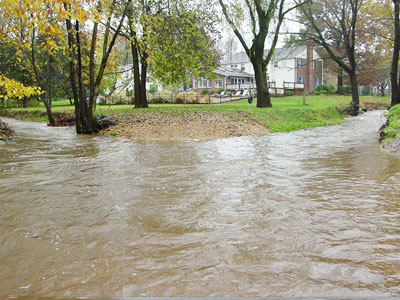
Floodplains are necessary for a healthy ecosystem. They provide the opportunity for water to spread out and slow down reducing erosion and flooding of other areas, they support biological diversity, and they recharge groundwater. Floodplains can also offer opportunities for recreation and open space. But when floodplains are developed or are built upon, the additional impervious surface and structures can contribute to greater flood damage and environmental degradation. The regulation and protection of floodplains is an important municipal responsibility. The activities that are permitted within floodplains are regulated by each municipality in Chester County through their floodplain maps and floodplain regulations.
The most recent update of Chester County floodplain maps by the Federal Emergency Management Agency (FEMA) became effective on September 29, 2017. The FEMA maps identify a Base Flood elevation (often referred to as the "100-hundred-year floodplain") which is defined as a flood which has a one percent chance of occurring in any single year. Note that while these storms have historically had a one percent chance of occurring annually, their frequency has been increasing in recent years making the regulation and protection of flood-prone areas even more important. Following the adoption of the updated floodplain maps in 2017, Chester County municipalities reviewed and revised their floodplain standards for consistency with FEMA and state requirements.
Benefits
Reduced Area-wide Flooding
Protecting floodplains helps to reduce the frequency and magnitude of flooding and stormwater impacts affecting people, property, infrastructure and public services.
Natural Resource and Greenway Protection
Floodplains help protect natural resources, including riparian and aquatic resources and habitats. Wildlife and greenway corridors can also be preserved through protecting floodplains.
Pollution Reduction
Floodplains can reduce stormwater pollutant loads and protect and improve the chemical, physical, and biological quality of both ground and surface waters.
Reduction of Impervious Surfaces
Protection of floodplains and associated reductions of impervious surfaces promote infiltration and reduce the volume and negative impacts of stormwater runoff.
Effective Regulatory Protection and Risk Management
Up-to-date floodplain regulations and mapping identify areas where development is more susceptible to flooding, providing communities with effective risk assessment tools and procedures to limit damage.
Improves Responses to Floods
Floodplain regulations can include mitigation provisions, funding, resources and emergency response measures after flood events.
Floodplain Insurance
Municipally-adopted floodplain regulations and updated FEMA maps allow citizens to buy flood insurance through the Federal National Flood Insurance Program. This program provides insurance to property owners, renters and businesses in flood-prone areas who may not otherwise be able to purchase insurance.
Accurate floodplain mapping enhances risk management by identifying areas susceptible to flooding.
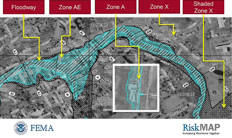
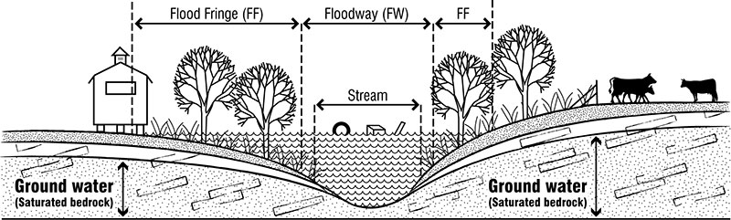
Floodplain components mapped by FEMA as shown in Chester County Flood Resiliency Tools, Techniques and Resources.
Municipal floodplain regulations consistent with FEMA standards are a prerequisite to participation in the National Flood Insurance Program.
Get Started
Municipalities must comply with Chapter 106 of the Pennsylvania Code by including floodplain regulations in their local regulations. A municipality may take one of two basic approaches in enacting its floodplain management regulations: updating the regulations within an existing code (typically the zoning ordinance) or adopting a single-purpose ("stand-alone") ordinance.
Zoning Regulations
Floodplain management regulations are typically located in the zoning ordinance as an overlay district that places special requirements over the land located within the 100-year floodplain.
Stand-Alone Ordinance
Municipalities may enact a "stand-alone ordinance." Doing this, however, would require the municipality to adopt separate enforcement standards and identify an administrator to enforce the ordinance, such as a building codes officer or zoning officer.
Coordinate with Other Ordinances
Municipalities should review their existing subdivision and land development ordinances, and other regulations, amending them as needed to refer to and coordinate with their floodplain management ordinances. Compliance with all subdivision, land development and zoning regulations should be contingent upon compliance with floodplain regulations.
As more extreme weather events are experienced with climate change, the limits of mapped floodplains may increase.
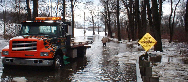
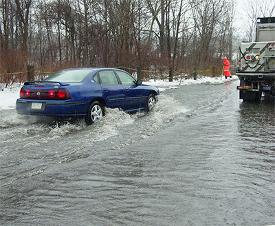
Floodplains should remain clear of structures to avoid property damage and reduce downstream flooding.
Considerations
Development within Floodplains
While FEMA does allow for some development to occur within floodplain boundaries when special conditions, such as specific floodproofing, are met it is highly recommended that development not be permitted within the 100-year floodplain because of increased risk for property damage and increasing the magnitude of flooding downstream. Some exceptions to this may be seen in urban areas which have historically been located along floodplain areas.
Floodplain Insurance
Homeowners outside of, but in proximity of mapped floodplains, should consider purchasing floodplain insurance due to the increased occurrence of more unpredictable and intense rain events in recent years.
Floodplain Boundary Disputes
Disputes may occur when property owners believe that floodplain maps are incorrect and assert that their proposed developments will not significantly increase flood magnitudes or that dangers of flooding are not significant. Property owners have a process available to them for contesting the location of floodplain boundaries.
Lender Requirements
Mortgage lenders will require floodplain insurance prior to issuing loans for properties located within regulated floodplains. Lenders may require site-specific floodplain measurements prior to issuing loans.
Comprehensive Natural Resource Protection
While floodplain protection is very important, it does not provide comprehensive resource protection. To most effectively protect resources, municipalities should also enact protection standards for riparian buffers, woodlands, wetlands, and steep slopes.
Floodplain elevation.
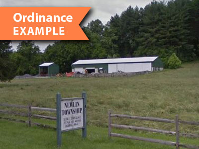
Rural
Newlin Township Floodplain Regulations are located in the zoning ordinance and provide an example of floodplain regulations in a rural setting.
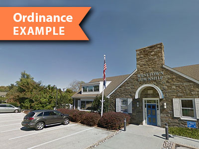
Suburban
Westtown Township Floodplain Regulations are located within the Natural Features Protection section of the zoning code and provide an example of floodplain regulations in a suburban setting.

Urban
Malvern Borough Floodplain Overlay District is located in the zoning code and provides an example of floodplain regulations in an urban setting.