

Woodlands Mapping and Tree Inventories
Woodlands Mapping
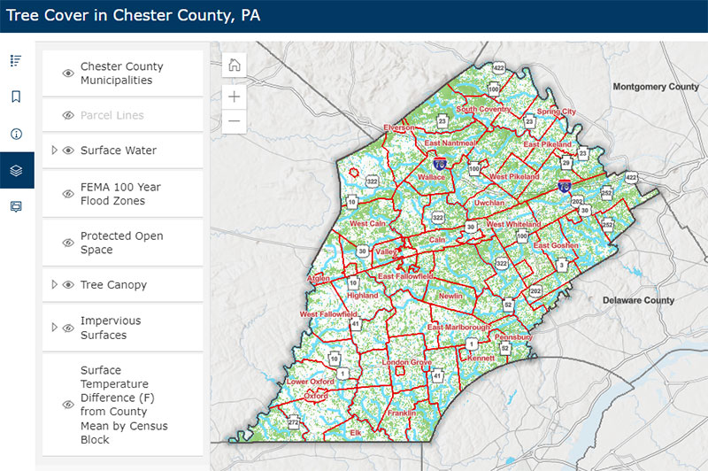
The Chester County Planning Commission developed an interactive map showing the county's tree canopy cover. Additional map layers, such as protected open space, flood zones, and impervious surfaces, can be turned off and on for more detailed analysis. This mapping can be useful in determining where gaps exist in tree coverage and where tree planting efforts could have the most impact. The Tree Cover map layer is a composite of forest, tree canopy over turf grass, and tree canopy over impervious surface as mapped in 2018 by the Chesapeake Conservancy, U.S. Geological Survey, and University of Vermont Spatial Analysis Lab. It is anticipated that the woodland cover data will be updated every four years.
The Planning Commission also maintains a wide array of Natural Resources related mapping and inventory information including the Chester County Natural Heritage Inventory.
View the Tree Cover in Chester County Map
Tree Inventories
A professional tree inventory allows for enhanced management and maintenance of a community's trees. Inventorying and assessing existing trees can help avoid expensive emergency tree services, reduce risk to people and property, and provide the basis for a tree management plan tailored to each community.
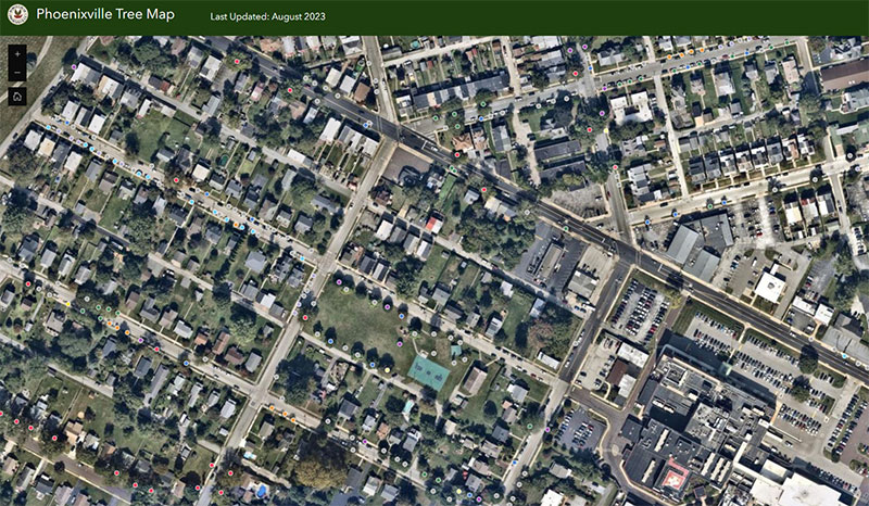
The Phoenixville Borough Urban Forest Hub site provides information and resources to support the stewardship of the borough's trees. The site includes an interactive tree inventory showing the tree species, condition, size and other information. The hub also includes borough tree data (e.g., percent of trees by species, condition, size, and location), a tree equity score map, the financial benefits of trees, and a wide range of educational resources for proper tree planting and management.
The West Chester Borough Urban Forest Hub site provides a wealth of valuable information about the borough's urban canopy, its benefits, tree maintenance and care, and information on the goals for the future of West Chester's urban forest. The site includes an interactive map of borough street trees with information on the tree species, size, and condition of each mapped tree.
The Wisconsin Department of Natural Resources maintains an Urban Forest website that includes a useful section on Tree Inventory resources and their benefits.
For additional urban tree resources, including financial and technical assistance, visit the PA DCNR Urban and Community Forestry website.
For additional information on how to conduct a community tree inventory, visit the Penn State Extension website.
For a tool on assessing and identifying benefits tool for individual trees and canopies, visit the i-Tree website.