

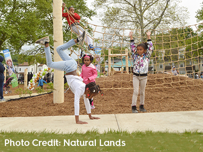
The Greening Coatesville initiative, a partnership of the City of Coatesville, Natural Lands, and the Brandywine Health Foundation, is revitalizing Coatesville's parks. Palmer Park now has a splash area and nature-based play area.
How it Works
Climate change and rising temperatures compound the effects of urban heat islands. Various strategies may reduce the amount of heat radiating off of urban areas including:
- Reducing the amount of pavement/structure
- Providing more reflective surfaces and/or lighter colors
- Providing more shade and vegetation
Reduce Pavement and Structures
Expansive impervious surfaces such as parking areas or wide sidewalks with little vegetation can be assessed to determine if they are overdesigned for size and underdesigned for landscaping. Sometimes it is possible to green a portion of a parking lot that is not used or to install street trees within an existing sidewalk.
Increase Reflective Surfaces
In areas where a heat island is identified, light-colored concrete can be substituted for asphalt. Additionally, the roofs of buildings with flat roofs can be painted white or another light color to reflect heat and lighter color roofing materials can be used for pitched roofs. Greenroofs can also significantly reduce heat radiating from roofs. This change also impacts heating and cooling costs within the building.
Provide More Shade
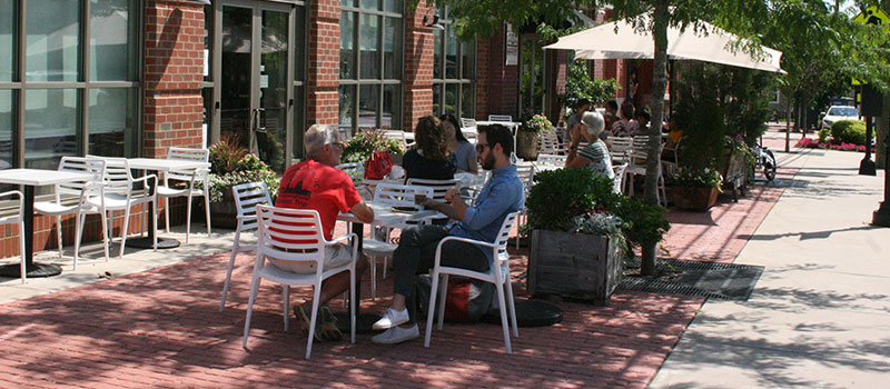
Planting trees is one of the best ways to mitigate urban heat islands because, in addition to providing shade, they provide a host of other benefits as well. Shade structures can also be used.
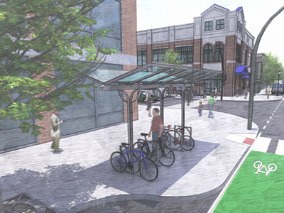
Providing shade where people will be congregating within an urban heat island, such as a bus shelter, can create more comfortable conditions.
Benefits
Environmental
Increasing tree and vegetation cover lowers surface and air temperatures by providing shade and cooling through evapotranspiration, while also improving air quality. Trees also can aid in the absorption of stormwater and the provision of wildlife habitat.
Public Health
Extreme heat events exacerbated within urban heat islands contribute to heat-related illnesses and death. Those most vulnerable to heat-related health issues are usually sensitive populations such as older adults, young children, low-income populations, people who work outdoors, the chronically ill, and those with mobility challenges who can't easily seek shelter from extreme heat. Efforts to mitigate urban heat islands ultimately will result in less heat-related ailments overall, and more equitable health outcomes amongst community members.
Social Equity
Oftentimes neighborhoods where low-income or other disadvantaged residents live have less tree canopy coverage than other parts of the urban center. Residents in these neighborhoods are already more vulnerable to extreme heat, and mitigating urban heat islands in these areas can create the most significant benefits.
Energy Conservation
Mitigating urban heat islands can reduce nearby buildings' need for air conditioning. Light colored roofs or "cool roofs" reflect sunlight and heat away from a building, reduce heat absorbed by the roof, and thereby reduce the need for air conditioning (though cool roofs can create more need for heat in winter).
Increased Property Value
Proximity to green space, parks, and street trees has been shown to increase property value, which can lead to greater equity for homeowners and increased tax base for municipalities and school districts.
Economic Development
Establishing quality green spaces and green infrastructure in urban locations can enhance the urban environment, attracting new businesses, customers, and residents, spurring economic development in urban centers.
Heat Island Effect

Image source: EPA
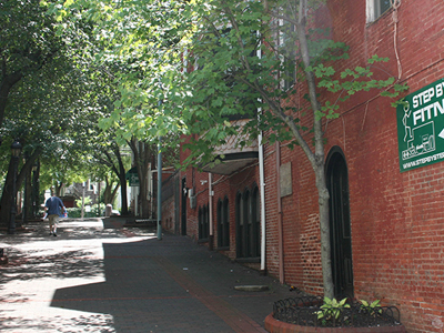
Trees and buildings shade this pedestrian alleyway in Phoenixville, reducing heat emitted from the pavement and buildings.
Get Started
The first step to mitigating urban heat islands is to identify where they are located. DVRPC has a number of resources that identify census tracts and block groups where temperatures are greater than the mean for the county, and where these areas overlap with vulnerable populations. These can be used as screening tools, but there is no substitute for querying residents and conducting field reconnaissance to identify specific heat island areas.
An urban municipality interested in combating urban heat island effect can identify these areas in its comprehensive plan and include strategies that support green initiatives that inherently have heat reduction as a primary intent or co-benefit. Many municipalities also have plans that focus specifically on sustainability, open space, recreation, natural resources, energy conservation, green infrastructure, and re-greening, and these plans can include an analysis of existing heat islands and associated mitigation strategies.
A municipality's zoning and subdivision ordinances should require as part of the subdivision and land development process street trees along roads and sidewalks and landscaping that includes shade trees within parking lots. Ordinances can provide design standards for the public realm, including green spaces, and can specify other heat-related measures for the built environment. If a heat island is identified in a particular area, a zoning overlay district could be designated that sets forth requirements to specifically address the issue. A requirement for greenspace within a development should be included within the zoning ordinance, and the design criteria for that greenspace should be included in the subdivision and land development ordinance. Ordinance requirements for landscaping and screening should be reviewed to ensure installation of appropriate vegetation while providing flexibility in complex or difficult urban scenarios.
Official maps could potentially be used to identify parcels or corridors that may be vulnerable to urban heat island effect and to identify locations for future greenspace, street tree planting, or other heat mitigation techniques.
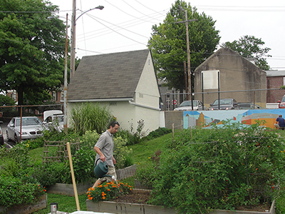
A community garden in West Chester Borough is an example of an urban greenspace that can help mitigate urban heat islands.
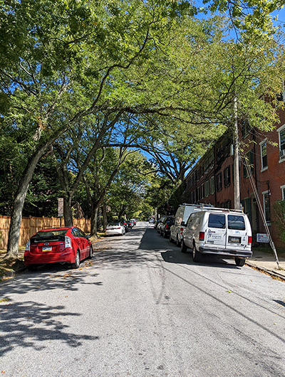
Mature honey locust trees on a residential street in West Chester Borough create dappled shade and enhance the streetscape.
Considerations
Funding Making changes within the built environment, whether through planting street trees or depaving projects, costs money. Many urban heat island reduction strategies can be achieved through incentives for developers or by requiring certain standards within zoning codes. The private sector may be required to invest in urban green spaces on their property or through a fee in lieu of parkland through the land development process. Local, county, state, and federal funding sources and mechanisms are available for the installation of vegetation and other strategies, but costs associated with retrofitting the built environment to reduce heat can be avoided by ensuring installation of these features during initial project construction.
Private Property
The primary source of the heat island effect — such as a parking lot — may be located on private property, and the property owner may or may not be willing to help address the issue. Municipalities, non-profits, or local organizations may help to engage property owners and provide guidance and information where remedies might provide heat reduction benefits.
Ongoing Maintenance
Converting paved area to unpaved area, whether a park or a tree trench, generally increases maintenance requirements. Urban green spaces like parks, street trees, and woodlands require varying levels of maintenance. Naturalistic landscapes tend to be less maintenance-intensive than more manicured landscapes, although public works staff may lack training in managing naturalistic landscape management. Urban trees must be periodically inspected for disease and potential hazards like dead limbs overhanging paths. Municipalities can develop a shade tree commission to manage the trees within the public realm. "Friends" groups, Tree Tenders, land conservancies, and other non-profits can also be valuable partners.
Right Tree, Right Place
It is important to select the right type of tree for its intended planting location. Trees can impact above and below ground utilities, cause sidewalk heaving, and can drop fruits, nuts and limbs that can damage vehicles or cause tripping hazards. Selecting the right tree for its location can alleviate or avoid these potential issues. Ordinance requirements for street trees and landscaping should be reviewed and updated periodically.
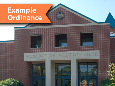
The West Chester Borough Tree Ordinance acknowledges the public benefit of trees and creates regulations that aim to preserve, protect and restore the health of existing trees within the Borough and to promote the planting of new trees.
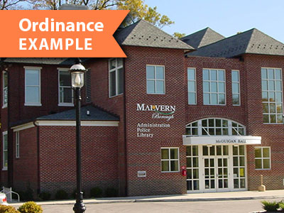
The Malvern Borough Shade Tree Commission oversees selection, planting, maintenance, and removal/replacement of all street trees. A number of urban municipalities have volunteer shade tree commissions to oversee the shade trees within the public realm.