


Pipeline Maps
 Interactive PIC Mapping Application
The interactive map of existing transmission pipeline corridors in Chester County allows you to zoom in on a specific area of interest. If you click on the area, a pop up box will appear giving you basic information on the pipeline operator. View Map
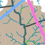
 Pipeline Operators in Chester County
A map showing pipelines and their operators in Chester County. View Map
 Regional Pipeline Network and Marcellus Shale Map
A map showing Chester County in the context of the regional pipeline network and the Marcellus Shale Formation. View Map
 Pipelines and Woodlands and Wetlands
A map showing wetlands, woodlands, and waterways. View Map
 Pipelines and Historic Resources and Protected Open Space
A map showing national registered listed and eligible resources, the Brandywine Battlefield National Historic landmark, and protected open spaces. View Map
 Pipelines and Hydrologic Resources
A map showing FEMA Floodplain Zones and DEP Stream Designations. View Map
 Pipelines and Community Facilities
A map showing schools, hospitals, police stations, and fire stations. View Map
 Pipelines and Landscapes Map
A map showing pipelines and Chester County's Landscapes Map, a guide for growth and rural resource protection described in further detail in the County's comprehensive plan (Landscapes3). View Map
 National Pipeline Mapping System
The National Pipeline Mapping System (NPMS) is an online mapping system that can help you locate pipelines anywhere in the country. For more detailed pipeline information in Chester County see our interactive map above. The NPMS site is managed by the US Department of Transportation's Pipeline Hazardous Materials Safety Administration (PHMSA). Maps generated with the NPMS show the approximate location of gas and hazardous liquids transmission pipelines. View Website
 Gas Infrastructure Map of Pennsylvania
This interactive map, courtesy of the Clean Air Council, shows Gas Infrastructure in Pennsylvania. The map shows compressor stations, liquefied natural gas pumping stations, proposed pipelines, and other features of gas infrastructure. Please note: viewers must register with the Clean Air Council to access the mapping application. View Map
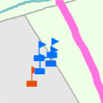
Chester County Legislative Districts and Pipelines
Below are maps showing Chester County federal and state legislative districts with an overlay of pipeline locations.
